Air conditioning in Royal Wootton Bassett
Yes, and in most of the town it’s straightforward. The High Street is a conservation area, with 52 list entries in a 2 km square around the Town Hall, most of them brick fronts. We found no Article 4 direction there, so an unlisted house keeps the national right on the conservation area’s terms. Wiltshire Council decides, and we check your building before we quote.
At a glance
- Who decides
- Wiltshire Council.
- Conservation area
- Wootton Bassett: essentially the High Street and its frontages, about 23 hectares.
- Article 4
- None in the government’s planning data or Wiltshire Council’s own list, though the data warns it may be incomplete.
52
entries on the National Heritage List in this 2 km square: 0 at Grade I, 2 at Grade II* and 50 at Grade II, among 3,996 buildings. One entry can cover a whole row.
A hilltop town on a ridge of Corallian limestone above the clay of the Dauntsey Vale. Unlike its stone neighbours, the High Street is mostly brick, often laid to make patterns.
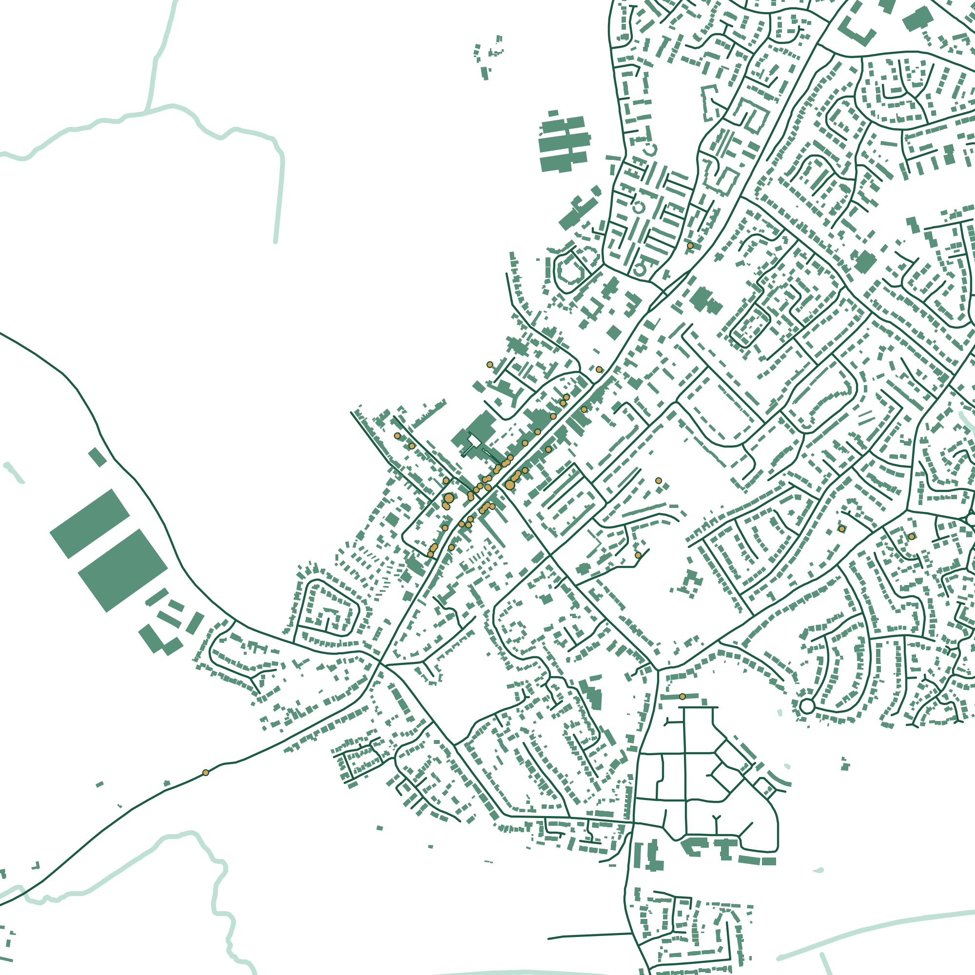
Press a number to find a building.
About 1700, restored in 1889. A timber-framed upper floor on fifteen tapered columns of oolite, under stone slate. List entry
14th and 15th century, restored by G. E. Street. Coursed limestone rubble under stone slate. List entry
Built 1700 to 1703 for a solicitor. A limestone ashlar front, and a brick back. List entry
18th century. A brick front in diaper Flemish bond with dark glazed headers, and a stone side and rear wing. List entry
Dated 1742. Dark brick with finer red brick dressings, under stone slate. List entry
Our count and drawing, 20 November 2026. Buildings, roads and water © OpenStreetMap contributors. Contains Historic England data © Historic England, Open Government Licence.
The High Street
The conservation area is essentially the High Street: about 23 hectares and 750 metres from end to end, with 46 list entries inside it. Wiltshire Council has no appraisal of it on file, so the list entries are the best guide to what matters. It’s the street the town lined for 167 repatriation ceremonies between 2007 and 2011, which is why it has been Royal Wootton Bassett since October 2011.
The fronts are mostly brick, often patterned, and several are brick fronts on older stone buildings. No. 141 is the other way round: an ashlar front with a brick back. A pipe hole through a patterned brick front shows, so we look for a route at the back first.
If the house isn’t listed, the national right still applies in the conservation area, as long as the unit heats as well as cools: not on a wall or roof facing a road, and not nearer a road than the house. If it is listed, plan on listed building consent, for work inside as well as out.
The newer town
Most of the town is newer than the High Street. Wiltshire Council says housing has run well ahead of plan, mostly to the south and south-east, at Brynard’s Hill and Lower Woodshaw. On a newer house the ordinary limits apply: one outdoor unit, or two on a detached house, and the 37 dB noise test at the neighbour’s window.
The council’s main employment areas are Whitehill Industrial Estate, Interface Industrial Estate and Coped Hall Business Park. There’s no national planning right for units on business premises, so an office or warehouse is judged on how the unit changes the outside of the building. More for businesses.
Your own building
Check it in three steps.
Almost everything above turns on two questions: is it listed, and is it in a conservation area? Both answers are public. Or leave it to us.
- 1
Is it listed?
Search Historic England’s National Heritage List by name or address. A listing covers the whole building, inside and out.
Search the List - 2
A conservation area, or an Article 4 direction?
The government’s planning data map shows both by postcode. It says its data may not yet be complete, so we check with the council as well.
Conservation areasArticle 4 directionsWootton Bassett Conservation Area
- 3
Or leave it to us
We look both up before we quote, and tell you what they mean for where the unit can go.
See my price
How hot, how cold
We couldn’t find a long-term Met Office page for Royal Wootton Bassett itself. These are from Lyneham, about 7 km to the south-west.
- 21.5°
- average July high at Lyneham, 1991 to 2020
- 40
- air frost days a year at Lyneham
- 1,653
- hours of sun a year at Lyneham
Questions
Asked in Royal Wootton Bassett
Is the High Street a conservation area?
Yes. The Wootton Bassett Conservation Area is essentially the High Street and its frontages. An unlisted house there keeps the national right for heat pumps, but not on a wall or roof that faces a road.
Is there an Article 4 direction in Royal Wootton Bassett?
We found none, in the government’s planning data or in Wiltshire Council’s own list of directions. The data warns it may be incomplete, so we still check the address.
How do I find out if my house is listed?
Search the National Heritage List by address. There are 66 entries in the parish, and 46 of them are in the conservation area.
Sources
Buildings
- The Town Hall, National Heritage List entry 1363658
- Church of St Bartholomew and All Saints, National Heritage List entry 1183969
- 141 High Street, Mr Bevir’s Office, National Heritage List entry 1300222
- The Angel Hotel, National Heritage List entry 1300238
- The Cross Keys, National Heritage List entry 1022705
Planning and the place
Last checked 20 November 2026. This is a plain summary for people planning a job, not legal advice. Rules can apply differently to a specific address.